After enjoying the panoramic view from the overlook, walk back along Route 52 (proceeding east) for about 750 feet. When you reach the end of the guardrail, you will see the start of a yellow-blazed trail on the right. Turn right and follow the yellow-blazed trail into the woods. The trail soon crosses an old road and continues downhill to a beautiful stream that cascades over rocks. It...
Hike Description:
After enjoying the panoramic view from the overlook, walk back along Route 52 (proceeding east) for about 750 feet. When you reach the end of the guardrail, you will see the start of a yellow-blazed trail on the right. Turn right and follow the yellow-blazed trail into the woods. The trail soon crosses an old road and continues downhill to a beautiful stream that cascades over rocks. It crosses the stream, parallels it uphill, and then bears right, away from the stream.
A short distance ahead, the yellow-blazed trail ends at another woods road. Turn right onto this road, marked with the aqua blazes of the Long Path, then immediately turn left (south) and begin a steady uphill climb. You're still following the Long Path, but the trail is now marked both with aqua blazes and with the blue circular plastic discs of the New York State Department of Environmental Conservation (DEC), as you are now on state land. For the next half mile or so, you'll be climbing, steeply in places, towards the crest of the Shawangunk Ridge.
About a mile and a half from the start, the trail levels off, and you'll soon reach a beautiful viewpoint from the west side of the ridge. This is a good place to take a break - a welcome respite from the steep climb up the ridge.
The trail continues along the ridge for the next mile or so, with spectacular viewpoints on both sides of the ridge. You'll be walking over huge slabs of the unusual Shawangunk conglomerate rock, with the vegetation including scrub oak and pitch pine. After about half a mile, you'll come to some fascinating rock formations on the east side of the ridge, with the trail running near the edge of steep 30-foot-high cliffs.
About two hours from the start of the hike, the trail bears left and begins to descend from the ridge. The vegetation now changes to the hardwoods characteristic of this area. Soon, the trail crosses several stone walls. A short distance beyond, the trail bears right and begins to parallel a rock escarpment to the left. After crossing a stone wall, the trail bears sharply left and climbs the escarpment on an easy route. You've now gone 3.5 miles from the start, and this is another good place to take a break.
Soon, the trail begins to ascend through a scrub oak forest. It again reaches the ridge, with good views in several directions. The trail continues along the ridge, with some ups and downs, for over a mile, with the scrub oak remaining the predominant vegetation, along with some blueberries and mountain laurel. This section is not as spectacular as the first stretch along the ridge, but it is easy walking, with a number of scenic lookouts.
After about 45 minutes of this ridgetop walking, you'll reach a memorial sign commemorating the work of Jack Hennessey, a dedicated volunteer trail maintainer. The trail now descends slightly from the ridge, then levels off. In another half a mile, you'll come to an outstanding viewpoint to the south -- another good spot for a break. The Wurtsboro Airport is visible in the valley below, with a very large Kohl's distribution center just beyond.
From this viewpoint, the trail descends steadily to cross Ferguson Road, six miles from the start of the hike.The trail then descends to cross a woods road and a stream. Here, a yellow-blazed side trail begins to the left (it heads east for 0.8 mile to a parking area on Ferguson Road, just west of Shawanga Lodge Road).
Climbing steadily, and paralleling the stream for part of the way, the Long Path finally reaches a large overhanging boulder, with views to the north over the Catskills, and to the south along the valley to the west of the ridge. Once more, the trail enters a wildly beautiful area characterized by pitch pine growing from cracks in conglomerate rock slabs. The trail ascends more gently, and finally levels off along the crest of the ridge. It reaches several more viewpoints over the valley to the west, with the Wurtsboro Airport overshadowed by the massive distribution center just to its south.
After about a mile of this delightful ridgetop walking, the trail crosses a gravel road. It then descends some more and crosses another road. Now the trail ascends rather steeply - the third, and final, ascent of the day. After regaining the ridgetop once more, the Long Path continues for about half a mile to a junction, marked by painted lettering on a rock. Here, the Long Path leaves to the left, but you should continue ahead on the Shawangunk Ridge Trail, also marked by blue DEC discs. The trail now begins to descend, first steeply, then more gradually. After about a mile, near the base of the descent, bear right onto a white-blazed side trail which leads for about 500 feet to the VFW post, where you left one of the two cars.
Publication: Submitted by Daniel Chazin on 10/24/2002 updated/verified on 06/14/2013

This one-way hike, which requires two cars, follows a little-used section of the Long Path along the spectacular Shawangunk Ridge, passing interesting cliffs and pitch pines growing from bedrock, with many views along the way on both sides of the ridge.
41.576966, -74.465316
Ulster Co., NY
10 mi
6.5 hrs

Web Map: Shawangunk Ridge Trail Map
Buy Map: *New* Shawangunk Trails Map
Avenza App Map: Shawangunk 106B
Hike Checklist:
Whether you are going for a day hike or backpacking overnight, it is good practice to carry what we call The Hiking Essentials. These essentials will help you enjoy your outing more and will provide basic safety gear if needed. There may also be more essentials, depending on the season and your needs.
The Essentials
Hiking Shoes or Boots
Water - Two quarts per person is recommended in every season. Keep in mind that fluid loss is heightened in winter as well as summer. Don't put yourself in the position of having to end your hike early because you have run out of water.
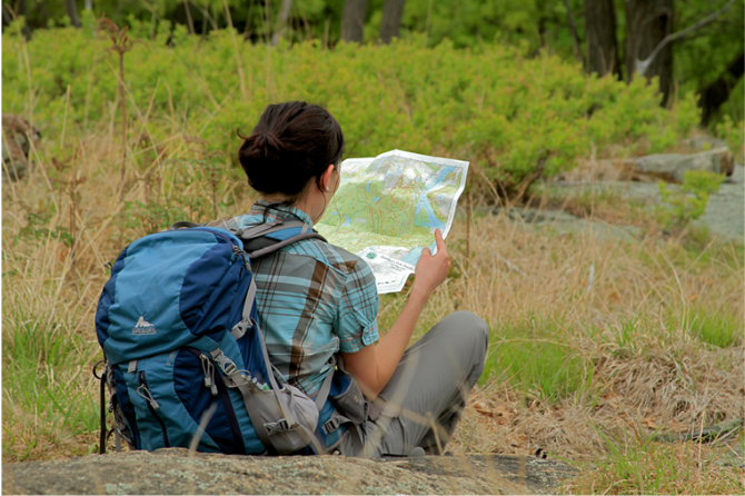
Map - Know where you are and where you are going. Many of our hiking areas feature interconnecting network of trails. Use a waterproof/tear-resistant Tyvek Trail Conference map if available or enclose your map in a Ziplock plastic bag. If you have a mobile device, download Avenza’s free PDF Maps app and grab some GPS-enhanced Trail Conference maps (a backup Tyvek or paper version of the map is good to have just in case your batteries die or you don't have service). Check out some map-reading basics here.
Food - Snacks/lunch will keep you going as you burn energy walking or climbing. Nuts, seeds, and chocolate are favorites on the trail.
Sunscreen and insect repellent
Rain Gear and Extra Clothing - Rain happens. So does cold. Be prepared for changing weather. Avoid cotton--it traps water against your skin and is slow to dry. If you are wearing wet cotton and must return to your starting point, you risk getting chills that may lead to a dangerous hypothermia. Choose synthetic shirts, sweaters and/or vests and dress in layers for easy on and off.
Compass - A simple compass is all you need to orient you and your map to magnetic north.
Light - A flashlight or small, lightweight headlamp will be welcome gear if you find yourself still on the trail when darkness falls. Check the batteries before you start out and have extras in your pack.
First Aid Kit - Keep it simple, compact, and weatherproof. Know how to use the basic components.
Firestarter and Matches - In an emergency, you may need to keep yourself or someone else warm until help arrives. A firestarter (this could be as simple as leftover birthday candles that are kept inside a waterproof container) and matches (again, make sure to keep them in a waterproof container) could save a life.
Knife or Multi-tool - You may need to cut a piece of moleskin to put over a blister, repair a piece of broken equipment, or solve some other unexpected problem.
Emergency Numbers - Know the emergency numbers for the area you're going to and realize that in many locations--especially mountainous ones, your phone will not get reception.
Common Sense - Pay attention to your environment, your energy, and the condition of your companions. Has the weather turned rainy? Is daylight fading? Did you drink all your water? Did your companion fail to bring rain gear? Are you getting tired? Keep in mind that until you turn around you are (typically) only half-way to completing your hike--you must still get back to where you started from! (Exceptions are loop hikes.)
Check the weather forecast before you head out. Know the rules and regulations of the area.
The Leave No Trace Seven Principles
Plan Ahead and Prepare
- Know the regulations and special concerns for the area you'll visit.
- Prepare for extreme weather, hazards, and emergencies.
- Schedule your trip to avoid times of high use.
- Visit in small groups when possible. Consider splitting larger groups into smaller groups.
- Repackage food to minimize waste.
- Use a map and compass to eliminate the use of marking paint, rock cairns or flagging.
Travel and Camp on Durable Surfaces
- Durable surfaces include established trails and campsites, rock, gravel, dry grasses or snow.
- Protect riparian areas by camping at least 200 feet from lakes and streams.
- Good campsites are found, not made. Altering a site is not necessary.
- In popular areas:
- Concentrate use on existing trails and campsites.
- Walk single file in the middle of the trail, even when wet or muddy.
- Keep campsites small. Focus activity in areas where vegetation is absent.
- In pristine areas:
- Disperse use to prevent the creation of campsites and trails.
- Avoid places where impacts are just beginning.
- Pack it in, pack it out. Inspect your campsite and rest areas for trash or spilled foods. Pack out all trash, leftover food and litter.
- Deposit solid human waste in catholes dug 6 to 8 inches deep, at least 200 feet from water, camp and trails. Cover and disguise the cathole when finished.
- Pack out toilet paper and hygiene products.
- To wash yourself or your dishes, carry water 200 feet away from streams or lakes and use small amounts of biodegradable soap. Scatter strained dishwater.
- Preserve the past: examine, but do not touch cultural or historic structures and artifacts.
- Leave rocks, plants and other natural objects as you find them.
- Avoid introducing or transporting non-native species.
- Do not build structures, furniture, or dig trenches.
- Campfires can cause lasting impacts to the backcountry. Use a lightweight stove for cooking and enjoy a candle lantern for light.
- Where fires are permitted, use established fire rings, fire pans, or mound fires.
- Keep fires small. Only use sticks from the ground that can be broken by hand.
- Burn all wood and coals to ash, put out campfires completely, then scatter cool ashes.
- Observe wildlife from a distance. Do not follow or approach them.
- Never feed animals. Feeding wildlife damages their health, alters natural behaviors, and exposes them to predators and other dangers.
- Protect wildlife and your food by storing rations and trash securely.
- Control pets at all times, or leave them at home.
- Avoid wildlife during sensitive times: mating, nesting, raising young, or winter.
Be Considerate of Other Visitors
- Respect other visitors and protect the quality of their experience.
- Be courteous. Yield to other users on the trail.
- Step to the downhill side of the trail when encountering pack stock.
- Take breaks and camp away from trails and other visitors.
- Let nature's sounds prevail. Avoid loud voices and noises.
The Trail Conference is a 2015 Leave No Trace partner.
(c) Leave No Trace Center for Outdoor Ethics: www.LNT.org.
Directions to Trailhead :
Take N.Y. Route 17 west to Exit 114 (Wurtsboro, Highview). Turn left at the end of the exit ramp onto Old Route 17 (County Route 171) and continue downhill for 0.7 mile. As the road makes a hairpin turn to the left, turn right onto a gravel road which leads to a VFW post. Park one car at the VFW post. With the second car, return to Old Route 17, turn left, and continue for about one mile (retracing your route for part of the way), then turn left onto Shawanga Lodge Road. Follow Shawanga Lodge Road north for about three miles to a stop sign at Pickles Road. Turn right, and continue on Pickles Road for 0.7 mile, then turn left at a stop sign onto Roosa Gap Road (there is no street sign for Roosa Gap Road here, but on the opposite side of the intersection, Pickles Road changes its name to Ski Run Road). Continue for two miles on Roosa Gap Road. When you reach an intersection where Frey Road begins to the right, bear left to continue on Pleasant Valley Road, and cross a bridge. In another 0.2 mile, turn left onto Cox Road, and follow it for about two miles to its end at N.Y. Route 52. Turn left onto Route 52, and continue for 1.7 miles to a scenic overlook on the left side of the road at the crest of a hill. Park the second car here.
TRAIN TRANSPORT :
Not availableBUS TRANSPORT :
Not availableShare Your Experience
SUPPORT
 Support the trails with a donation!
Trail Conference volunteers maintain trails in this hike.
Trip Reports
rate experience
No reviews for this hike, click above rate experience link to review this hike
Log in or register to post comments