From the Riday's Gate parking area, begin the hike by crossing the yellow metal gate and proceeding along the abandoned railroad grade of the historic WB&E (Wilkes-Barre and Eastern) Railroad which operated from 1892 to 1939. This part of the hike is not shown on the park map. The railroad grade ascends ever so gradually, barely noticeable as you walk along. Look behind you to see the...
Hike Description:
From the Riday's Gate parking area, begin the hike by crossing the yellow metal gate and proceeding along the abandoned railroad grade of the historic WB&E (Wilkes-Barre and Eastern) Railroad which operated from 1892 to 1939. This part of the hike is not shown on the park map. The railroad grade ascends ever so gradually, barely noticeable as you walk along. Look behind you to see the slight slope downward. A few low spots on the trail where water collects or flows through may be muddy but passable. While the railroad grade is virtually flat, the forest floor is not so there will be times when the trail is at ground level and times when it towers above atop an earthen embankment providing sweeping views of the woods down below.
[Editor's note: Portions of the railroad grade pass through private lands. Please remain on the trail until you reach the red-blazed trail. Even then, if you venture off-trail, be aware the slopes, especially the warmer south-slope, are prime rattlesnake habitat.]
At 1.1 miles the railroad grade continues straight ahead as it becomes the red-blazed North Trail Lower Loop, now shown at the far right center of the park map. The trail to the left is the return route of the red-blazed North Trail Lower Loop later in the hike. Please sign the trail register in the brown box on the post. Continuing straight, the railroad grade now curves to the left between vertical stone walls, gradually mingling with rhododendron.
At 1.9 miles the red-blazed North Trail Lower Loop makes a sharp left turn - if you miss the turn you will know within a very short time as you reach the no trespassing zone of the Camelback Ski Corporation. Although the railroad grade continues across the ski slopes into State Game Lands 38 on the other side of the mountain, you may not pass through the ski area.
After the sharp left turn, the trail becomes noticeably steeper and will climb around 900 feet over the next mile. At 2.1 miles turn right where the red-blazed North Trail Lower Loop becomes the red-blazed North Trail. The trail now ascends very steeply but with no rock scrambles. Be sure to watch your footing on loose gravel. Where you started out at around 1,200 feet elevation, you will arrive at the summit of Camelback Mountain at 2,132 feet.
At 2.8 miles turn right on the orange-blazed trail that soon terminates at Rim Road, a paved one-way road that circles the mountaintop. A clearing on the right with a picnic table and bench offers a view to the north.
Cross Rim Road and continue on an unmarked gravel path to Parking Lot #4. Cross the parking lot and continue on the path to the right of the picnic area. A few trails will cross over - these lead to restrooms, picnic areas and back over to Rim Road. You can turn off to explore here or continue straight on the path arriving at Parking Lot #2 and the mountain summit with unobstructed views on both sides. You will literally feel like you have arrived at the top of the world. Grab a bench for a break spot with a spectacular view.
Since cars can drive to the summit of Camelback Mountain, you won't be alone in this area except from mid-December to spring when Camelback Road access to the summit is closed. Make note of the kiosk straight ahead with restrooms to the left. You will be taking a trail to the left of the restroom building to continue on but first walk ahead a short distance to the stone cabin built in 1908 by Henry Cattell who owned the land at the turn of the 20th century. A historic fire tower a little further, is still staffed in the spring and fall but is not accessible to the public. Over on the north slope of Camelback Mountain are the ski lifts and slopes of the Camelback Ski Area.
When finished exploring the mountaintop, return to the restroom building on the south side near the kiosk. Look for a trail to the left of the restrooms and proceed along that trail to Parking Lot #3. Veer to the right through the parking lot, walking out the entrance; cross over Rim Road and follow the sign for the South Trail. This puts you on the yellow-blazed Vista Trail. A short distance ahead a very touching memorial on the right commemorates the young man who built the trail for his senior high school project.
At the end of the Vista Trail, turn left on the yellow-blazed South Trail to a view on the right by a large boulder. Wind Gap, PA, directly ahead, is identified by a dip in the mountain range atop which sits the Appalachian Trail. The Kittatinny Mountain extends to the left of Wind Gap and the Blue Mountain to the right. As your eyes pan the horizon, picture the Appalachian Trail following that ridge for many, many miles.
Continue on along the yellow-blazed South Trail in the direction you were heading but don't be concerned if yellow blazes are hard to find - there aren't many but the trail is easy to follow even with heavy leaf cover. When the leaves are down, the Kittatinny Mountain range can be seen between the trees along this entire section the South Trail.
Around 4 miles, the Scout Trail on the left, built by a young man for his Scout project, leads back to Rim Road. Continue straight ahead to a clearing on the right with views of the Delaware Water Gap - Mount Tammany, NJ on the left and Mount Minsi, PA on the right.
Arrive at an intersection at 4.3 miles where the South Trail turns right. Leave the South Trail by continuing straight on the orange-blazed Indian Trail. This trail will be rocky for a while. A very brief downhill rock scramble might require use of hands for support. At 4.7 miles the trail veers left as several short trails to the right lead to ledges with views from the north all the way to the east. High Point monument in New Jersey is to the northeast but may be difficult to see from 40 miles away. The Delaware Water Gap can be seen again to the east. Although an unofficial trail travels along the ledge, it is dangerously close to a sheer drop down, so best to return to the Indian Trail to access other areas of the ledge from additional side trails along the way.
Continuing on the orange-blazed trail, arrive at a bench at an intersection at 5.2 miles. Turn left here and after a short distance the Indian Trail loop is completed back at the intersection with the South Trail; continue straight on the yellow-blazed South Trail. The trail will now start to switchback down steeply at times. Watch your footing on loose gravel.
The South Trail ends at an intersection at 6.35 miles where the red-blazed North Trail goes left and the red-blazed North Trail Lower Loop goes right. Turn right on the red-blazed North Trail Lower Loop.
The next intersection at 6.85 miles completes the loop back at the trail register from the beginning of the hike. The red-blazed North Trail Lower Loop continues to the left. Turn right here to proceed on the blue-blazed railroad grade, not marked at this intersection and not shown on the map. Arrive back at Riday's Gate at 8 miles.
Turn By Turn Description:
[ 0.00] From Riday's Parking Lot take the blue-blazed old railroad grade
[ 0.30] Cross over second yellow metal gate
[ 1.10] Straight on red-blazed North Trail Lower Loop at trail register intersection
[ 1.90] Red-blazed North Trail Lower Loop makes sharp left turn
[ 2.10] Turn right at intersection on red-blazed North Trail; ascend more steeply
[ 2.50] Keep right at fork; trail switchbacks up
[ 2.60] Keep right at intersection; keep left at fork short distance ahead
[ 2.80] Turn right on orange-blazed trail at end of North Trail
[ 2.90] Cross Rim Road continuing on gravel path
[ 3.15] Arrive at summit at Parking Lot #2
[ 3.35] Cattell Cabin - return to kiosk, face restroom, take trail to left of restrooms
[ 3.45] Veer right through Parking Lot #3, walk out entrance, cross Rim Road; take yellow-blazed Vista Trail to South Trail
[ 4.05] Scout Trail comes in from left; views of Delaware Water Gap on right
[ 4.30] At intersection proceed straight on orange-blazed Indian Trail
[ 4.70] Trail goes left while multiple side trail to the right go to views along ledges
[ 5.20] Turn left at intersection by bench; keep straight on South Trail ahead
[ 6.35] Turn right on red-blazed North Trail Lower Loop at end of South Trail
[ 6.70] Stay right at fork
[ 6.85] Turn right on blue-blazed old railroad grade where red-blazed trail turns left
[ 7.70] Cross yellow metal gate
[ 8.00] Arrive back at Riday's Gate parking area


Hike along the old Wilkes-Barre and Eastern railroad grade and up Camelback Mountain for top-of-the-world views.
41.03597, -75.34211
Lehigh Co., PA
8 mi
4 hrs

Hike Checklist:
Whether you are going for a day hike or backpacking overnight, it is good practice to carry what we call The Hiking Essentials. These essentials will help you enjoy your outing more and will provide basic safety gear if needed. There may also be more essentials, depending on the season and your needs.
The Essentials
Hiking Shoes or Boots
Water - Two quarts per person is recommended in every season. Keep in mind that fluid loss is heightened in winter as well as summer. Don't put yourself in the position of having to end your hike early because you have run out of water.
Map - Know where you are and where you are going. Many of our hiking areas feature interconnecting network of trails. Use a waterproof/tear-resistant Tyvek Trail Conference map if available or enclose your map in a Ziplock plastic bag. If you have a mobile device, download Avenza’s free PDF Maps app and grab some GPS-enhanced Trail Conference maps (a backup Tyvek or paper version of the map is good to have just in case your batteries die or you don't have service). Check out some map-reading basics here.
Food - Snacks/lunch will keep you going as you burn energy walking or climbing. Nuts, seeds, and chocolate are favorites on the trail.
Sunscreen and insect repellent
Rain Gear and Extra Clothing - Rain happens. So does cold. Be prepared for changing weather. Avoid cotton--it traps water against your skin and is slow to dry. If you are wearing wet cotton and must return to your starting point, you risk getting chills that may lead to a dangerous hypothermia. Choose synthetic shirts, sweaters and/or vests and dress in layers for easy on and off.
Compass - A simple compass is all you need to orient you and your map to magnetic north.
Light - A flashlight or small, lightweight headlamp will be welcome gear if you find yourself still on the trail when darkness falls. Check the batteries before you start out and have extras in your pack.
First Aid Kit - Keep it simple, compact, and weatherproof. Know how to use the basic components.
Firestarter and Matches - In an emergency, you may need to keep yourself or someone else warm until help arrives. A firestarter (this could be as simple as leftover birthday candles that are kept inside a waterproof container) and matches (again, make sure to keep them in a waterproof container) could save a life.
Knife or Multi-tool - You may need to cut a piece of moleskin to put over a blister, repair a piece of broken equipment, or solve some other unexpected problem.
Emergency Numbers - Know the emergency numbers for the area you're going to and realize that in many locations--especially mountainous ones, your phone will not get reception.
Common Sense - Pay attention to your environment, your energy, and the condition of your companions. Has the weather turned rainy? Is daylight fading? Did you drink all your water? Did your companion fail to bring rain gear? Are you getting tired? Keep in mind that until you turn around you are (typically) only half-way to completing your hike--you must still get back to where you started from! (Exceptions are loop hikes.)
Check the weather forecast before you head out. Know the rules and regulations of the area.
The Leave No Trace Seven Principles
Plan Ahead and Prepare
- Know the regulations and special concerns for the area you'll visit.
- Prepare for extreme weather, hazards, and emergencies.
- Schedule your trip to avoid times of high use.
- Visit in small groups when possible. Consider splitting larger groups into smaller groups.
- Repackage food to minimize waste.
- Use a map and compass to eliminate the use of marking paint, rock cairns or flagging.
Travel and Camp on Durable Surfaces
- Durable surfaces include established trails and campsites, rock, gravel, dry grasses or snow.
- Protect riparian areas by camping at least 200 feet from lakes and streams.
- Good campsites are found, not made. Altering a site is not necessary.
- In popular areas:
- Concentrate use on existing trails and campsites.
- Walk single file in the middle of the trail, even when wet or muddy.
- Keep campsites small. Focus activity in areas where vegetation is absent.
- In pristine areas:
- Disperse use to prevent the creation of campsites and trails.
- Avoid places where impacts are just beginning.
- Pack it in, pack it out. Inspect your campsite and rest areas for trash or spilled foods. Pack out all trash, leftover food and litter.
- Deposit solid human waste in catholes dug 6 to 8 inches deep, at least 200 feet from water, camp and trails. Cover and disguise the cathole when finished.
- Pack out toilet paper and hygiene products.
- To wash yourself or your dishes, carry water 200 feet away from streams or lakes and use small amounts of biodegradable soap. Scatter strained dishwater.
- Preserve the past: examine, but do not touch cultural or historic structures and artifacts.
- Leave rocks, plants and other natural objects as you find them.
- Avoid introducing or transporting non-native species.
- Do not build structures, furniture, or dig trenches.
- Campfires can cause lasting impacts to the backcountry. Use a lightweight stove for cooking and enjoy a candle lantern for light.
- Where fires are permitted, use established fire rings, fire pans, or mound fires.
- Keep fires small. Only use sticks from the ground that can be broken by hand.
- Burn all wood and coals to ash, put out campfires completely, then scatter cool ashes.
- Observe wildlife from a distance. Do not follow or approach them.
- Never feed animals. Feeding wildlife damages their health, alters natural behaviors, and exposes them to predators and other dangers.
- Protect wildlife and your food by storing rations and trash securely.
- Control pets at all times, or leave them at home.
- Avoid wildlife during sensitive times: mating, nesting, raising young, or winter.
Be Considerate of Other Visitors
- Respect other visitors and protect the quality of their experience.
- Be courteous. Yield to other users on the trail.
- Step to the downhill side of the trail when encountering pack stock.
- Take breaks and camp away from trails and other visitors.
- Let nature's sounds prevail. Avoid loud voices and noises.
The Trail Conference is a 2015 Leave No Trace partner.
(c) Leave No Trace Center for Outdoor Ethics: www.LNT.org.
Directions to Trailhead :
From I-80 west, about 15 minutes into Pennsylvania from the Delaware Water Gap, take exit 299 for PA-715 towards Tannersville, PA. Turn left on PA-715 south. After ½ mile, turn right on Railroad Avenue. Proceed a little over 1 mile to Riday's Gate parking on the right where there is room for 3-4 cars.
TRAIN TRANSPORT :
Not availableBUS TRANSPORT :
Not available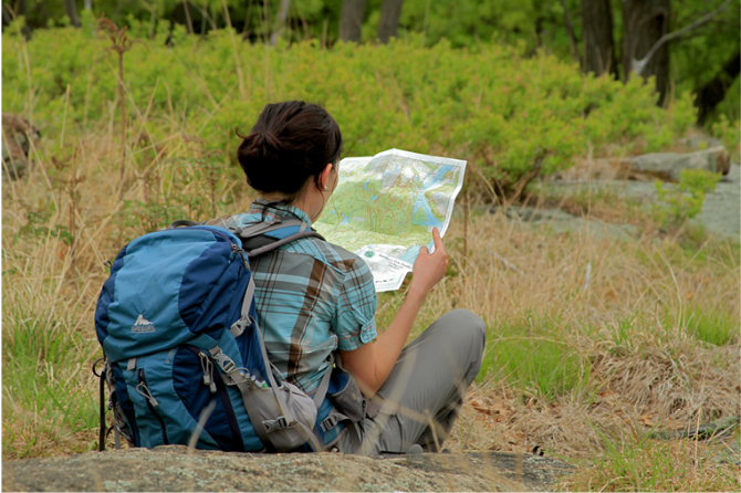
 Support the trails with a donation!
Trip Reports
rate experience December 22, 2016
Did this hike today
Did this hike today. Directions were on point and accurate. Views from the top of the mountain were spectacular. Doing this hike in the winter was a good choice, since the snow covers the rocky parts of the trail and the lack of leaves affords a nice view through the trees.
September 15, 2016
great hike with lots of variety
<p>Did this hike today (9/15/16), and it's a hike with a great deal of variety. The first section (along the railroad bed) is, almost by definition, quite flat, but you are quite aware of how much work went into that level grade, with alternating hugely built-up sections alternating with almost canyon-like cuts in the bedrock. Then you get to do some serious climbing up to the essentially flat top of Camelback Mtn. The views from there are quite spectacular, though no photograph can possibly do justice to the panoramas to both the north and south. I was amazed that one could clearly see the Devil's Path section of the Catskill Mountains, which are about 100 miles to the north. (The weather today was exceptionally good, with quite clean air. It's probably worth mentioning that you should schedule this hike on such a day; otherwise you'll probably see a big smudge from the top!) The views along the Indian Trail were also great. Finally, there is the descent, which is generally moderate.</p>
<p>A couple of comments about the typically excellent writeup: (1) The sign-in box mentioned is clearly still there, but no longer operational, as the box is nailed shut. (2) There are a couple of spots on the North Trail ascent where there were forks (first one at N 41º02'48.1, W 75º20'30.8" and the second one at N 41º02'44.9", W 75º20'33.5"), and it wasn't obvious which way to go. It turns out that it doesn't really matter as the left fork in both cases is a switchback that avoids quite steep sections of the original trail.</p>
October 24, 2012
map link
<p>Here is a new link for the trail map: <a href="http://www.dcnr.state.pa.us/ucmprd1/groups/public/documents/document/dcnr_004983.pdf">http://www.dcnr.state.pa.us/ucmprd1/groups/public/documents/document/dcnr_004983.pdf</a></p>