A sign at the north end of the parking lot indicates the route of the blue-blazed William Hoeferlin Trail. Proceed north on this trail, following a woods road through a forest of hemlock, mountain laurel and deciduous trees. In a quarter mile, you’ll reach an intersection with the white-blazed Appalachian Trail (A.T.). Turn left and follow the A.T., which heads into the woods on a footpath....
Hike Description:
A sign at the north end of the parking lot indicates the route of the blue-blazed William Hoeferlin Trail. Proceed north on this trail, following a woods road through a forest of hemlock, mountain laurel and deciduous trees. In a quarter mile, you’ll reach an intersection with the white-blazed Appalachian Trail (A.T.). Turn left and follow the A.T., which heads into the woods on a footpath.
In a short distance, a blue-blazed trail on the right leads to the Wawayanda Shelter, situated on the top of a rise. Overnight camping by A.T. hikers is permitted here, and you might want to take a short detour to this wooden shelter. Continue ahead on the A.T., which soon begins a gradual descent to the dirt Old Wawayanda Road, which it crosses diagonally to the left. The A.T. now climbs a rise, then descends gradually. Near the base of the descent, it crosses a woods road, and it heads west parallel to the northern shore of Kazmar Lake (visible through the trees on the left).
About half a mile from Old Wawayanda Road, follow the A.T. as it turns left onto the dirt Iron Mountain Road (the route of the blue-blazed Iron Mountain Trail) and begins a steady descent. At the base of the descent, the road crosses Wawayanda Creek on an iron bridge that dates to the 1890s (although the wooden deck and railing are newer). Just past the bridge, the A.T. bears right, leaving the road, but you should bear left to continue on the Iron Mountain Trail.
The Iron Mountain Trail climbs to the crest of a rise, descends to cross a stream, climbs gradually and levels off. In 1.2 miles, you’ll pass a locked gate and reach the park entrance road. Here, there is a small shelter with a bench on the left if you want to take a short break. Cross the road and proceed south, still following the blue blazes.
Soon, you’ll reach the southern end of the Iron Mountain Trail near the parking lot for Wawayanda Lake. Head towards the lake, but when you reach the edge of the parking lot parallel to the lake, turn left and walk towards the southeast corner of the parking lot. Here, you should head east on a wide dirt road, parallel to an arm of the lake.
A short distance ahead, you’ll pass a stone dam on the right. Wawayanda Lake was originally known as Double Pond, since it consisted of two separate bodies of water before the Thomas Iron Company constructed a stone dam here in 1862. The blue-blazed Wingdam Trail begins at the dam and heads south, but you should continue ahead along the wide dirt road.
Just ahead, you’ll cross a wooden footbridge amid stone ruins and reach the historic Wawayanda Furnace. Built in 1846 by Oliver Ames and his sons to smelt the iron ore mined in the area, it was in operation for only about 20 years. The furnace is largely intact, and plaques on its east side relate some of its interesting history.
After taking some time to explore the area, proceed ahead, crossing a gravel road. Continue to the left of two composting restrooms, and cross a bridge over a stream. Here, the yellow-blazed Double Pond Trail begins.
Proceed ahead on the Double Pond Trail, which bears left at a fork and continues along a gravel road through a group campsite. Soon, the trail descends slightly to cross a wetland on a boardwalk. Just beyond, the Red Dot Trail begins on the right, but you should continue ahead on the Double Pond Trail.
You now enter the Wawayanda Swamp Natural Area – a fascinating and ecologically significant tract - and the vegetation changes to a dense mix of hemlock, mountain laurel and rhododendron. Soon, the trail begins to pass through dense rhododendron thickets. Especially after heavy rains, portions of the trail may be quite wet (unless you wear waterproof boots, be prepared to get your feet wet), but the beauty of the rhododendron thickets makes this trail section one not to be missed! The trail is particularly spectacular when the rhododendron is in bloom – usually, the first week in July. The winter is also a good time to hike this trail, as the wet ground is often frozen (although you may want to bring along traction devices).
About a mile from the furnace, you’ll come to a fork. The blue-blazed Cedar Swamp Trail begins on the right, but you should bear left to continue on the Double Pond Trail. In a third of a mile, you’ll pass on the right the trailhead of the red-blazed Plymouth Lane Trail. A short distance beyond – just before a turnaround at the end of the driveable road – turn left onto the blue-blazed William Hoeferlin Trail and immediately pass through a dense rhododendron tunnel.
The William Hoeferlin Trail follows an old woods road which has narrowed to a footpath, and sections of the trail are quite rocky. The vegetation becomes a mix of rhododendron, hemlock and mountain laurel, with deciduous trees gradually becoming more dominant. After climbing gradually for 1.3 miles, you’ll reach a bend in the trail where the Black Eagle Trail begins on the left. Continue ahead on the blue-blazed William Hoeferlin Trail, which soon begins a steady descent, reaching the park office in another half mile. The parking lot where the hike began is just to the right.
Publication: Submitted by Daniel Chazin on 04/21/2006 updated/verified on 01/01/2017


This relatively level loop hike follows woods roads through this scenic park, passing through thick groves of rhododendron and hemlock, and goes by Wawayanda Lake and the historic Wawayanda Furnace.
41.198096, -74.397526
Sussex Co., NJ
6 mi
3.5 hrs

Avenza App Map: Northern New Jersey Highlands 152
Hike Checklist:
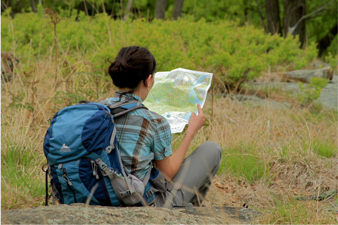
Whether you are going for a day hike or backpacking overnight, it is good practice to carry what we call The Hiking Essentials. These essentials will help you enjoy your outing more and will provide basic safety gear if needed. There may also be more essentials, depending on the season and your needs.
The Essentials
Hiking Shoes or Boots
Water - Two quarts per person is recommended in every season. Keep in mind that fluid loss is heightened in winter as well as summer. Don't put yourself in the position of having to end your hike early because you have run out of water.
Map - Know where you are and where you are going. Many of our hiking areas feature interconnecting network of trails. Use a waterproof/tear-resistant Tyvek Trail Conference map if available or enclose your map in a Ziplock plastic bag. If you have a mobile device, download Avenza’s free PDF Maps app and grab some GPS-enhanced Trail Conference maps (a backup Tyvek or paper version of the map is good to have just in case your batteries die or you don't have service). Check out some map-reading basics here.
Food - Snacks/lunch will keep you going as you burn energy walking or climbing. Nuts, seeds, and chocolate are favorites on the trail.
Sunscreen and insect repellent
Rain Gear and Extra Clothing - Rain happens. So does cold. Be prepared for changing weather. Avoid cotton--it traps water against your skin and is slow to dry. If you are wearing wet cotton and must return to your starting point, you risk getting chills that may lead to a dangerous hypothermia. Choose synthetic shirts, sweaters and/or vests and dress in layers for easy on and off.
Compass - A simple compass is all you need to orient you and your map to magnetic north.
Light - A flashlight or small, lightweight headlamp will be welcome gear if you find yourself still on the trail when darkness falls. Check the batteries before you start out and have extras in your pack.
First Aid Kit - Keep it simple, compact, and weatherproof. Know how to use the basic components.
Firestarter and Matches - In an emergency, you may need to keep yourself or someone else warm until help arrives. A firestarter (this could be as simple as leftover birthday candles that are kept inside a waterproof container) and matches (again, make sure to keep them in a waterproof container) could save a life.
Knife or Multi-tool - You may need to cut a piece of moleskin to put over a blister, repair a piece of broken equipment, or solve some other unexpected problem.
Emergency Numbers - Know the emergency numbers for the area you're going to and realize that in many locations--especially mountainous ones, your phone will not get reception.
Common Sense - Pay attention to your environment, your energy, and the condition of your companions. Has the weather turned rainy? Is daylight fading? Did you drink all your water? Did your companion fail to bring rain gear? Are you getting tired? Keep in mind that until you turn around you are (typically) only half-way to completing your hike--you must still get back to where you started from! (Exceptions are loop hikes.)
Check the weather forecast before you head out. Know the rules and regulations of the area.
The Leave No Trace Seven Principles
Plan Ahead and Prepare
- Know the regulations and special concerns for the area you'll visit.
- Prepare for extreme weather, hazards, and emergencies.
- Schedule your trip to avoid times of high use.
- Visit in small groups when possible. Consider splitting larger groups into smaller groups.
- Repackage food to minimize waste.
- Use a map and compass to eliminate the use of marking paint, rock cairns or flagging.
Travel and Camp on Durable Surfaces
- Durable surfaces include established trails and campsites, rock, gravel, dry grasses or snow.
- Protect riparian areas by camping at least 200 feet from lakes and streams.
- Good campsites are found, not made. Altering a site is not necessary.
- In popular areas:
- Concentrate use on existing trails and campsites.
- Walk single file in the middle of the trail, even when wet or muddy.
- Keep campsites small. Focus activity in areas where vegetation is absent.
- In pristine areas:
- Disperse use to prevent the creation of campsites and trails.
- Avoid places where impacts are just beginning.
- Pack it in, pack it out. Inspect your campsite and rest areas for trash or spilled foods. Pack out all trash, leftover food and litter.
- Deposit solid human waste in catholes dug 6 to 8 inches deep, at least 200 feet from water, camp and trails. Cover and disguise the cathole when finished.
- Pack out toilet paper and hygiene products.
- To wash yourself or your dishes, carry water 200 feet away from streams or lakes and use small amounts of biodegradable soap. Scatter strained dishwater.
- Preserve the past: examine, but do not touch cultural or historic structures and artifacts.
- Leave rocks, plants and other natural objects as you find them.
- Avoid introducing or transporting non-native species.
- Do not build structures, furniture, or dig trenches.
- Campfires can cause lasting impacts to the backcountry. Use a lightweight stove for cooking and enjoy a candle lantern for light.
- Where fires are permitted, use established fire rings, fire pans, or mound fires.
- Keep fires small. Only use sticks from the ground that can be broken by hand.
- Burn all wood and coals to ash, put out campfires completely, then scatter cool ashes.
- Observe wildlife from a distance. Do not follow or approach them.
- Never feed animals. Feeding wildlife damages their health, alters natural behaviors, and exposes them to predators and other dangers.
- Protect wildlife and your food by storing rations and trash securely.
- Control pets at all times, or leave them at home.
- Avoid wildlife during sensitive times: mating, nesting, raising young, or winter.
Be Considerate of Other Visitors
- Respect other visitors and protect the quality of their experience.
- Be courteous. Yield to other users on the trail.
- Step to the downhill side of the trail when encountering pack stock.
- Take breaks and camp away from trails and other visitors.
- Let nature's sounds prevail. Avoid loud voices and noises.
The Trail Conference is a 2015 Leave No Trace partner.
(c) Leave No Trace Center for Outdoor Ethics: www.LNT.org.
Directions to Trailhead :
Take I-287 to Exit 57 (Skyline Drive) and continue on Skyline Drive to its western terminus at Greenwood Lake Turnpike (County Route 511). Turn right and proceed north on Greenwood Lake Turnpike. In 8.3 miles, continue ahead on Warwick Turnpike (still County Route 511), following the sign for “Warwick, N.Y.” Proceed for another 4.5 miles to the entrance to Wawayanda State Park, on the left. Follow the entrance road for 0.3 mile to the parking lot at the park office..
TRAIN TRANSPORT :
Not availableBUS TRANSPORT :
Not availableShare Your Experience
SUPPORT
 Support the trails with a donation!
Trail Conference volunteers maintain trails in this hike.
Trip Reports
rate experience May 05, 2010
Hike description has been revised and is now correct
I have revised the hike description to reflect the trail changes pointed out by Bibienna. About two years ago, the Appalachian Trail was indeed rerouted in this area, and the beginning of the hike has now been rewritten. I have also removed the references to the green plastic blazes on the Double Pond Trail, as these have apparently been removed. The hike description can now be followed as written.
April 25, 2010
04-24-10 HIKE IS NO LONGER CORRECT
I took this hike yesterday. The beginning of the hike is not correct and a little confusing. I believe the Appalachian Trail has been shifted in this area.
Hoeferlin Trail does not end at a T intersection with the Appalachian Trail.
Hoeferlin Trail crosses AT and continues on.
Make left at AT off of the Hoeferlin Trail. This is a trail and not a woods road as noted in the hike (at least in my opinion).
The blue blazed trail to the Wawayanda Shelter is to the right ---not the left as noted in the hike.
When the AT comes to the Wawayanda Road it is picked up again directly across the road-----not .2 miles down the road as noted in the hike.
Finally, I saw only Yellow blazes for the Double Pond Trail. There were no green plastic blazes.