The Apshawa Preserve is a rugged 576-acre tract owned by Passaic County and the New Jersey Conservation Foundation. About seven miles of trails traverse this preserve, and this hike features the trails in the northern section of the preserve. The trails are marked with paint blazes and with colored plastic diamond blazes that incorporate the logo of the New Jersey Conservation Foundation (the...
Hike Description:
The Apshawa Preserve is a rugged 576-acre tract owned by Passaic County and the New Jersey Conservation Foundation. About seven miles of trails traverse this preserve, and this hike features the trails in the northern section of the preserve. The trails are marked with paint blazes and with colored plastic diamond blazes that incorporate the logo of the New Jersey Conservation Foundation (the trails used on this hike are primarily marked with paint blazes).
At the northern end of the parking area, go through a gate in a deer fence and follow the Blue Trail, which first proceeds along a woods road, but continues on a footpath. After crossing a wet area on puncheons, the Blue Trail bears left and descends to cross a stream. It then climbs a hill on a woods road, passing on the left the start of the Purple Trail. Continue ahead on the Blue Trail, which bears right at a high point and passes interesting rock formations on the left. Just beyond, the trail turns left, leaving the woods road, climbs over a rise and descends steeply into a ravine, where it turns left onto another woods road.
A short distance ahead, you’ll notice white blazes on a rock to the right. Turn right, leaving the Green Trail, and follow the White Trail, which soon begins to climb. At the top of the hill, you’ll pass through an area studded with cedars and soon reach a west-facing viewpoint, with the Butler Reservoir visible below. You’ll be hiking along the shoreline of this reservoir later on in the hike.
The trail now descends rather steeply to the southeast corner of the reservoir. Here, the White Trail goes through a gate in a deer fence and ends at a junction with the Red Trail. Turn right onto the Red Trail, which heads north parallel to the eastern shore of the reservoir, with views over the reservoir.
At the northern end of the reservoir, the Red Trail bears right, briefly follows a stream, and reaches a junction with the Yellow Trail. Turn left and continue on the Red Trail, which crosses a dam over a small pond and continues on a woods road. At a second junction with the Yellow Trail, follow the Red Trail as it turns left onto a footpath and soon rejoins the woods road. In a short distance, you’ll reach an open area to the left of the trail that affords a south-facing view over the Butler Reservoir, with several beaver dams visible in the reservoir.
After traversing a wet area, the trail crosses the wide inlet stream of the reservoir on a metal bridge. The trail now heads east, soon reaching the shore of the reservoir. It heads south parallel to the shore, soon passing a rock ledge that affords a nice view over the reservoir. Just beyond, the trail climbs briefly to avoid a steep rock face, but for most of the next half mile, the trail closely parallels the shore of the scenic reservoir. At one point, an unmarked trail on the left leads to a large rock outcrop overlooking the reservoir.
After several private homes come into view (on the right) near the southwest corner of the reservoir, the trail crosses some wet areas and turns left onto a woods road. A short distance beyond, a gravel road on the left leads to a secondary dam, with views over the reservoir. The Green Trail soon joins from the right, and you should follow both red and green blazes along the road.
Be alert for a right turn, where the Red and Green Trail turn right and descend. (If you want a final panoramic view over the reservoir, continue ahead to the dam.) A short distance ahead, the trails cross Apshawa Brook on a metal bridge just below the dam of the reservoir (due to safety concerns, the historic stone dam has been breached and a concrete spillway constructed to lower the water level of the reservoir.)
On the other side of the bridge, follow the Green Trail as it turns right and goes through a gate. The Green Trail loops around and soon reaches a junction with the Blue Trail, which begins on the left. Turn left onto the Blue Trail and follow it all the way back to the parking area, where the hike began.
Publication: Submitted by Daniel Chazin on 12/07/2007 updated/verified on 05/19/2020

This hike follows woods roads and footpaths through the preserve, looping around the scenic Butler Reservoir.
41.025208, -74.374223
Passaic Co., NJ
4 mi
3 hrs

Web Map: Apshawa Preserve
Buy Map: Morris County Highlands Trails Map
Avenza App Map: Morris County Highlands 125
Hike Checklist:
Whether you are going for a day hike or backpacking overnight, it is good practice to carry what we call The Hiking Essentials. These essentials will help you enjoy your outing more and will provide basic safety gear if needed. There may also be more essentials, depending on the season and your needs.
The Essentials
Hiking Shoes or Boots
Water - Two quarts per person is recommended in every season. Keep in mind that fluid loss is heightened in winter as well as summer. Don't put yourself in the position of having to end your hike early because you have run out of water.
Map - Know where you are and where you are going. Many of our hiking areas feature interconnecting network of trails. Use a waterproof/tear-resistant Tyvek Trail Conference map if available or enclose your map in a Ziplock plastic bag. If you have a mobile device, download Avenza’s free PDF Maps app and grab some GPS-enhanced Trail Conference maps (a backup Tyvek or paper version of the map is good to have just in case your batteries die or you don't have service). Check out some map-reading basics here.
Food - Snacks/lunch will keep you going as you burn energy walking or climbing. Nuts, seeds, and chocolate are favorites on the trail.
Sunscreen and insect repellent
Rain Gear and Extra Clothing - Rain happens. So does cold. Be prepared for changing weather. Avoid cotton--it traps water against your skin and is slow to dry. If you are wearing wet cotton and must return to your starting point, you risk getting chills that may lead to a dangerous hypothermia. Choose synthetic shirts, sweaters and/or vests and dress in layers for easy on and off.
Compass - A simple compass is all you need to orient you and your map to magnetic north.
Light - A flashlight or small, lightweight headlamp will be welcome gear if you find yourself still on the trail when darkness falls. Check the batteries before you start out and have extras in your pack.
First Aid Kit - Keep it simple, compact, and weatherproof. Know how to use the basic components.
Firestarter and Matches - In an emergency, you may need to keep yourself or someone else warm until help arrives. A firestarter (this could be as simple as leftover birthday candles that are kept inside a waterproof container) and matches (again, make sure to keep them in a waterproof container) could save a life.
Knife or Multi-tool - You may need to cut a piece of moleskin to put over a blister, repair a piece of broken equipment, or solve some other unexpected problem.
Emergency Numbers - Know the emergency numbers for the area you're going to and realize that in many locations--especially mountainous ones, your phone will not get reception.
Common Sense - Pay attention to your environment, your energy, and the condition of your companions. Has the weather turned rainy? Is daylight fading? Did you drink all your water? Did your companion fail to bring rain gear? Are you getting tired? Keep in mind that until you turn around you are (typically) only half-way to completing your hike--you must still get back to where you started from! (Exceptions are loop hikes.)
Check the weather forecast before you head out. Know the rules and regulations of the area.
The Leave No Trace Seven Principles
Plan Ahead and Prepare
- Know the regulations and special concerns for the area you'll visit.
- Prepare for extreme weather, hazards, and emergencies.
- Schedule your trip to avoid times of high use.
- Visit in small groups when possible. Consider splitting larger groups into smaller groups.
- Repackage food to minimize waste.
- Use a map and compass to eliminate the use of marking paint, rock cairns or flagging.
Travel and Camp on Durable Surfaces
- Durable surfaces include established trails and campsites, rock, gravel, dry grasses or snow.
- Protect riparian areas by camping at least 200 feet from lakes and streams.
- Good campsites are found, not made. Altering a site is not necessary.
- In popular areas:
- Concentrate use on existing trails and campsites.
- Walk single file in the middle of the trail, even when wet or muddy.
- Keep campsites small. Focus activity in areas where vegetation is absent.
- In pristine areas:
- Disperse use to prevent the creation of campsites and trails.
- Avoid places where impacts are just beginning.
- Pack it in, pack it out. Inspect your campsite and rest areas for trash or spilled foods. Pack out all trash, leftover food and litter.
- Deposit solid human waste in catholes dug 6 to 8 inches deep, at least 200 feet from water, camp and trails. Cover and disguise the cathole when finished.
- Pack out toilet paper and hygiene products.
- To wash yourself or your dishes, carry water 200 feet away from streams or lakes and use small amounts of biodegradable soap. Scatter strained dishwater.
- Preserve the past: examine, but do not touch cultural or historic structures and artifacts.
- Leave rocks, plants and other natural objects as you find them.
- Avoid introducing or transporting non-native species.
- Do not build structures, furniture, or dig trenches.
- Campfires can cause lasting impacts to the backcountry. Use a lightweight stove for cooking and enjoy a candle lantern for light.
- Where fires are permitted, use established fire rings, fire pans, or mound fires.
- Keep fires small. Only use sticks from the ground that can be broken by hand.
- Burn all wood and coals to ash, put out campfires completely, then scatter cool ashes.
- Observe wildlife from a distance. Do not follow or approach them.
- Never feed animals. Feeding wildlife damages their health, alters natural behaviors, and exposes them to predators and other dangers.
- Protect wildlife and your food by storing rations and trash securely.
- Control pets at all times, or leave them at home.
- Avoid wildlife during sensitive times: mating, nesting, raising young, or winter.
Be Considerate of Other Visitors
- Respect other visitors and protect the quality of their experience.
- Be courteous. Yield to other users on the trail.
- Step to the downhill side of the trail when encountering pack stock.
- Take breaks and camp away from trails and other visitors.
- Let nature's sounds prevail. Avoid loud voices and noises.
The Trail Conference is a 2015 Leave No Trace partner.
(c) Leave No Trace Center for Outdoor Ethics: www.LNT.org.
Directions to Trailhead :
Take I-287 to Exit 53 (Bloomingdale) and turn left onto Hamburg Turnpike. Upon entering Bloomingdale, the name of the road changes to Main Street. When you reach a fork in 1.3 miles (from Route 287), bear right, but at the next fork (in another 0.1 mile), bear left to continue on Hamburg Turnpike. Follow Hamburg Turnpike for another 1.3 miles, then turn right onto Macopin Road. In 1.9 miles, turn left onto Northwood Drive. Proceed for 500 feet and turn right into the parking area for the Apshawa Preserve.
TRAIN TRANSPORT :
Not availableBUS TRANSPORT :
Not available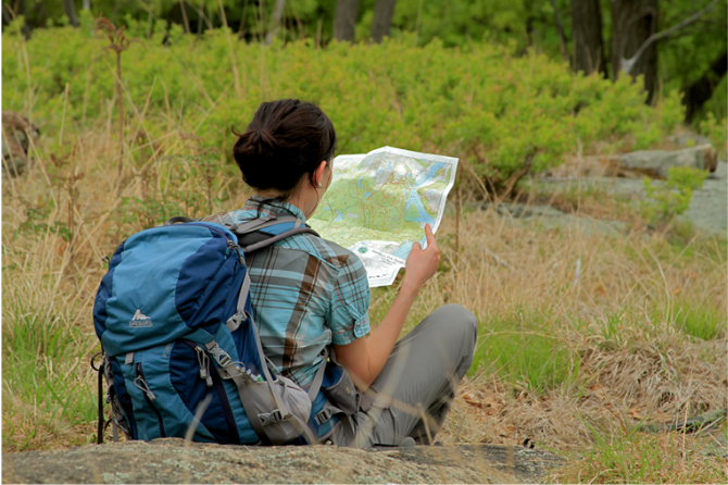
 Support the trails with a donation!
Trip Reports
rate experience July 13, 2024
Less Traveled Loop in a Small Preserve
We hiked this Apshawa Preserve loop on a hot early-July day, enjoying the cooler temperatures in the forest at the side of the reservoir.
The parking lot was a generous size, and essentially empty, and trailhead access was clearly marked with a sign board. Blazes were plentiful and easy to follow at both footpath and woods roads, including well marked trail junctions - a good thing as the actual single track footpath was barely traveled in some sections, disappearing into the grassy weeds. The hike description is accurate to the actual conditions that we found, and the 'Moderate' designation is also accurate. There are only a few short vertical sections that require careful scrambling up or down, but the overall loop is on the easier side of Moderate. We also used the color-coded, letter-size trail map available for download at the New Jersey Conservation Foundation webpage for the Preserve:
https://www.njconservation.org/preserve/apshawa-preserve/
There were some muddy spots that could have used a few sections of boardwalk/puncheons, but easy to cross with caution. There were also a few large blow-downs across the trail, but herd paths typically lead the alternate walk-around.
We saw evidence that beavers remain active, with signs that they are maintaining the dam at the small pond. The beaver also seemed to be active at the inlet stream at the northwest corner of the reservoir, but the water level had dropped in that area, leaving a large muddy area. Crossing the beaver dam at the pond required caution, as the trail was moist, hidden in weeds, and very narrow. We saw no evidence of the closed Yellow trail – we assume that trail has been fully abandoned since it was closed to hikers back in 2014. The trailhead bulletin board also makes clear that the Yellow trail is closed.
We enjoyed the many viewpoints of the reservoir, which is really not much more than a pond. Since the water level is lower than the height of the dam, lilypads are present throughout. Definitely classic beaver habitat. The rock faces on the west side of the reservoir were a good rest stop for snacks and water. We also appreciated the few vistas at the highest points of the trail.
The trail description mentions nearby residences, but these were not visible anywhere. We could hear noise from the adjacent roads, but the interior of the hike was quiet.
Overall maintenance is not up to Trail Conference standards - so the disclaimer in the trail description heading makes sense. The aluminum bridges were in good, stable condition, but piled up with debris on the upstream sides likely from recent heavy storms. If that continues, the bridges might be tipped over. We were also careful at the deer gates, only to find that sections of the deer fence are missing and some gates do not latch - so much for protecting the interior of the Preserve.
Based on the ease of access and parking, and the quality of the hike, we would likely return in the Fall season to try the Green trail loop.
August 17, 2018
Hike description has been updated
<p>In response to the comment, I have updated the hike description by deleting the portion of the hike that follows the Yellow Trail, which has been impassable for some time and is now officially closed. I have also corrected the error with regard to the Blue Trail.</p>
August 17, 2018
The Yellow Trail is impassable
I did (or should say I tried to do) the trail today, 8/17/18. The Yellow Trail is mostly gone now. Even with bushwacking, I couldn't get around the far eastern end of the small pond. I backtracked to the Red Trail, crossed to the northern side of the pond and tried to follow the Yellow Trail, clockwise around the pond and again the trail vanishes into brush and swamp. After I got back to thee parking lot, I read on the bulletin board that the Yellow Trail is closed indefinitely. Second small item, in the route description, in the 3rd paragraph, 2nd sentence, it talks about turning off the Green Trail. This should read "turn off the Blue Trail". This should be pretty obvious. And if this error confused you, you'll probably get a lot more lost on this trail!!