At the entrance to the 242nd Street station on the east side of Broadway (opposite the overpass), descend a short stairway into the park and turn left onto a wide path. After passing a restroom building on the left and green buildings that surround the park’s pool on the right, you’ll come to the Van Cortlandt House Museum (open Tuesday to Friday from 10 a.m. to 3 p.m., and on weekends from 11...
Hike Description:
At the entrance to the 242nd Street station on the east side of Broadway (opposite the overpass), descend a short stairway into the park and turn left onto a wide path. After passing a restroom building on the left and green buildings that surround the park’s pool on the right, you’ll come to the Van Cortlandt House Museum (open Tuesday to Friday from 10 a.m. to 3 p.m., and on weekends from 11 a.m. to 4 p.m.). This historic stone building, built in 1748, is the oldest building in the Bronx. George Washington actually slept here! There is a $5.00 admission charge for a self-guided tour of this fascinating building, which has been beautifully restored.
After touring the building and its grounds, head east along a service road, passing the Parade Ground on the left and the park’s Nature Center and tennis courts on the right. At the end of the fields, as the service road curves to the left, turn right and follow a dirt path, with stone steps, that descends through the woods to the Putnam Trail. On the right, you’ll notice 13 stone pillars, known as the Grand Central Stones. These were placed there by the New York Central Railroad to determine which type of stone weathered best.
Turn left onto the Putnam Trail, which follows the right-of-way of the abandoned Putnam Branch of the New York Central Railroad. Built in 1880 as part of a projected through route to Boston, the line offered commuter service for many years. Although passenger service was abandoned in 1958, occasional freight service was operated until 1981. The right-of-way is now paved, and little remains from its former rail use.
After crossing a wide bridge over Tibbetts Brook, with Van Cortlandt Lake on the right, continue heading north along the Putnam Trail, which follows a wooded route between the Van Cortlandt Golf Course (on the right) and the brook (on the left). Although you’re in the center of the Bronx, the sights – and even the sounds – of civilization are absent along this stretch of the hike. In about half a mile, though, after passing beneath an overpass of the Mosholu Parkway, you’ll begin to parallel the Henry Hudson Parkway on the left.
When you reach the end of the fence that separates the Putnam Trail from the golf course, turn right, leaving the railbed, and follow a wide path parallel to the fence along the northern end of the golf course for a short distance. Continue along the wide path when it bears left and heads north, away from the golf course. Bear left at the next two intersections, continuing to follow the wide path, which curves to the right and heads uphill.
Soon, you’ll notice in the distance on the left a massive stone retaining wall. This wall supports the Old Croton Aqueduct, which you will soon be following. Built about 1840 to provide the first source of pure drinking water to New York City, it remained in service until the 1950s.
The wide path now bears left and climbs two sets of stone steps to reach the route of the Aqueduct. Turn right, then immediately bear right at a fork, following the sign for the Old Croton Aqueduct Trail. Continue heading south along the Aqueduct, with a low stone wall in the woods on the left.
In about ten minutes, you’ll reach a large stone structure. Known as a weir, this structure was used to regulate the flow of water in the Aqueduct. Just beyond, the pink-blazed John Muir Trail leaves to the right, but you should continue ahead on the wide Aqueduct route.
Soon, the Aqueduct begins to parallel the Mosholu Parkway, which is below on your right. When you reach a junction with a paved path, turn right, following the sign for “Van Cortlandt Lake & Golf House.” You now leave the Aqueduct route and continue south on a wide macadam path along the Mosholu Parkway. The path soon bears left and climbs to the Major Deegan Expressway, where it follows the sidewalk across a bridge that spans the Mosholu Parkway. The bridge offers seasonal west-facing views over Van Cortlandt Lake, directly below, with the tall apartment buildings of Riverdale visible in the distance.
At the end of the bridge, continue ahead on an ADA-compliant ramp, which descends gradually, curving sharply to the right and paralleling an entrance ramp to the Major Deegan Expressway. At the bottom, turn sharply right, and follow a paved path that curves left and passes beneath a highway ramp overpass, with a chain-link fence on the right.
When the fence ends, continue ahead on a paved path, parallel to the southern edge of scenic Van Cortlandt Lake. When you reach a fork, bear right, continuing to follow a wide paved path along the lakeshore. Soon, you’ll pass in front of the golf clubhouse. Just beyond, bear right and head towards a blue-painted steel bridge of the Putnam Trail (which spans an arm of the lake).
Turn left onto the Putnam Trail, which you’ll follow for only a short distance. Just ahead, you’ll pass the rusting steel supports of the canopy for the former Van Cortlandt Park railroad station. At the end of these steel supports, turn left, then immediately bear right onto a paved path and continue through the underpass beneath the railbed (note the date “1904" inscribed in the abutment).
On the opposite side, bear left, then bear right at a fork and follow a wide path that heads west to the 242nd Street station, where the hike began.
Publication: Submitted by Daniel Chazin on 01/26/2004 updated/verified on 09/11/2017


This loop hike passes the historic Van Cortlandt House Museum, follows the abandoned Putnam rail line and the Old Croton Aqueduct, and goes by the scenic Van Cortlandt Lake.
40.889574, -73.898324
Bronx Co., NY
3 mi
2 hrs

Web Map: Map and Guide - Van Cortlandt Park
Hike Checklist:
Whether you are going for a day hike or backpacking overnight, it is good practice to carry what we call The Hiking Essentials. These essentials will help you enjoy your outing more and will provide basic safety gear if needed. There may also be more essentials, depending on the season and your needs.
The Essentials
Hiking Shoes or Boots
Water - Two quarts per person is recommended in every season. Keep in mind that fluid loss is heightened in winter as well as summer. Don't put yourself in the position of having to end your hike early because you have run out of water.
Map - Know where you are and where you are going. Many of our hiking areas feature interconnecting network of trails. Use a waterproof/tear-resistant Tyvek Trail Conference map if available or enclose your map in a Ziplock plastic bag. If you have a mobile device, download Avenza’s free PDF Maps app and grab some GPS-enhanced Trail Conference maps (a backup Tyvek or paper version of the map is good to have just in case your batteries die or you don't have service). Check out some map-reading basics here.
Food - Snacks/lunch will keep you going as you burn energy walking or climbing. Nuts, seeds, and chocolate are favorites on the trail.
Sunscreen and insect repellent
Rain Gear and Extra Clothing - Rain happens. So does cold. Be prepared for changing weather. Avoid cotton--it traps water against your skin and is slow to dry. If you are wearing wet cotton and must return to your starting point, you risk getting chills that may lead to a dangerous hypothermia. Choose synthetic shirts, sweaters and/or vests and dress in layers for easy on and off.
Compass - A simple compass is all you need to orient you and your map to magnetic north.
Light - A flashlight or small, lightweight headlamp will be welcome gear if you find yourself still on the trail when darkness falls. Check the batteries before you start out and have extras in your pack.
First Aid Kit - Keep it simple, compact, and weatherproof. Know how to use the basic components.
Firestarter and Matches - In an emergency, you may need to keep yourself or someone else warm until help arrives. A firestarter (this could be as simple as leftover birthday candles that are kept inside a waterproof container) and matches (again, make sure to keep them in a waterproof container) could save a life.
Knife or Multi-tool - You may need to cut a piece of moleskin to put over a blister, repair a piece of broken equipment, or solve some other unexpected problem.
Emergency Numbers - Know the emergency numbers for the area you're going to and realize that in many locations--especially mountainous ones, your phone will not get reception.
Common Sense - Pay attention to your environment, your energy, and the condition of your companions. Has the weather turned rainy? Is daylight fading? Did you drink all your water? Did your companion fail to bring rain gear? Are you getting tired? Keep in mind that until you turn around you are (typically) only half-way to completing your hike--you must still get back to where you started from! (Exceptions are loop hikes.)
Check the weather forecast before you head out. Know the rules and regulations of the area.
The Leave No Trace Seven Principles
Plan Ahead and Prepare
- Know the regulations and special concerns for the area you'll visit.
- Prepare for extreme weather, hazards, and emergencies.
- Schedule your trip to avoid times of high use.
- Visit in small groups when possible. Consider splitting larger groups into smaller groups.
- Repackage food to minimize waste.
- Use a map and compass to eliminate the use of marking paint, rock cairns or flagging.
Travel and Camp on Durable Surfaces
- Durable surfaces include established trails and campsites, rock, gravel, dry grasses or snow.
- Protect riparian areas by camping at least 200 feet from lakes and streams.
- Good campsites are found, not made. Altering a site is not necessary.
- In popular areas:
- Concentrate use on existing trails and campsites.
- Walk single file in the middle of the trail, even when wet or muddy.
- Keep campsites small. Focus activity in areas where vegetation is absent.
- In pristine areas:
- Disperse use to prevent the creation of campsites and trails.
- Avoid places where impacts are just beginning.
- Pack it in, pack it out. Inspect your campsite and rest areas for trash or spilled foods. Pack out all trash, leftover food and litter.
- Deposit solid human waste in catholes dug 6 to 8 inches deep, at least 200 feet from water, camp and trails. Cover and disguise the cathole when finished.
- Pack out toilet paper and hygiene products.
- To wash yourself or your dishes, carry water 200 feet away from streams or lakes and use small amounts of biodegradable soap. Scatter strained dishwater.
- Preserve the past: examine, but do not touch cultural or historic structures and artifacts.
- Leave rocks, plants and other natural objects as you find them.
- Avoid introducing or transporting non-native species.
- Do not build structures, furniture, or dig trenches.
- Campfires can cause lasting impacts to the backcountry. Use a lightweight stove for cooking and enjoy a candle lantern for light.
- Where fires are permitted, use established fire rings, fire pans, or mound fires.
- Keep fires small. Only use sticks from the ground that can be broken by hand.
- Burn all wood and coals to ash, put out campfires completely, then scatter cool ashes.
- Observe wildlife from a distance. Do not follow or approach them.
- Never feed animals. Feeding wildlife damages their health, alters natural behaviors, and exposes them to predators and other dangers.
- Protect wildlife and your food by storing rations and trash securely.
- Control pets at all times, or leave them at home.
- Avoid wildlife during sensitive times: mating, nesting, raising young, or winter.
Be Considerate of Other Visitors
- Respect other visitors and protect the quality of their experience.
- Be courteous. Yield to other users on the trail.
- Step to the downhill side of the trail when encountering pack stock.
- Take breaks and camp away from trails and other visitors.
- Let nature's sounds prevail. Avoid loud voices and noises.
The Trail Conference is a 2015 Leave No Trace partner.
(c) Leave No Trace Center for Outdoor Ethics: www.LNT.org.
Directions to Trailhead :
Take the Henry Hudson Parkway to Exit 23A (NY 9 South, Broadway) and proceed south on Broadway to 242nd Street, where the elevated rail line ends. Parking is available on Broadway north of 242nd Street (alternate-side-of-the-street restrictions).
TRAIN TRANSPORT :
Take the #1 subway train to the 242nd Street Station (the northern end of the line).
BUS TRANSPORT :
Not available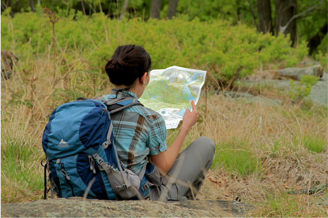
 Support the trails with a donation!
Trip Reports
rate experience September 12, 2017
New ramp is open; hike can once again be completed as described
<p>In May 2017, a new ADA-compliant ramp was opened at the intersection of the Major Deegan Expressway with the Moshulu Parkway. This ramp replaces a deteriorated stone staircase that had been closed for several years. During the period when the stairway was closed, it was impossible to complete this hike as described. Now that the ramp replacing the staircase has opened, it is once again possible to complete this delightful loop hike, which incorporates two historic rights-of-way in Van Cortlandt Park.</p>
September 15, 2015
Sidewalk and stairway are temporarily closed
<p><span style="color: #111111; font-family: Verdana, Arial, Helvetica, sans-serif; line-height: 14.5920000076294px; background-color: #ebf2f8;">Yes, unfortunately you are correct that the sidewalk along the Major Deegan Expressway and the stairway leading down to the lake are closed for repairs. I have been informed that the closing will last for about two years. To the best of my knowledge, there is no alterantive route to bypass the construction area, which means that the hike cannot be completed until the sidewalk is reopened. It is really unfortunate that this very attractive loop hike will not be accessible for this long period of time. Thank you for bring this to our attention. I will be updating the hike description to make this clear.</span></p>
September 14, 2015
Nice hike in the city but outdated instructions
<p>I found this hike to be a very nice one as a first hike for my 5 years old son and my wife, it's in the city, accessible by public transportation, a loop and it gives the feeling.</p>
<p>I printed the written instruction and started following them and everything was clear and perfect and we enjoyed the hike up to the point that said "<span style="color: #111111; font-family: Verdana, Arial, Helvetica, sans-serif; font-size: 12.1599998474121px; line-height: 14.5920000076294px; background-color: #edefd9;">The path soon bears left and climbs to the Major Deegan Expressway, where it follows the sidewalk across a bridge that spans the Mosholu Parkway. The bridge offers broad west-facing views over Van Cortlandt Lake, directly below, and Riverdale in the distance."</span></p>
<p><span style="color: #111111; font-family: Verdana, Arial, Helvetica, sans-serif; font-size: 12.1599998474121px; line-height: 14.5920000076294px; background-color: #edefd9;"><br></span></p>
<p><span style="color: #111111; font-family: Verdana, Arial, Helvetica, sans-serif; font-size: 12.1599998474121px; line-height: 14.5920000076294px; background-color: #ffffff;">The path that climbs the Major Degan Expressway was closed and there were no other signs showing an alternative route back to the park and it wasn't an option to follow the same way we can from as it was too far for my son to walk that distance, I started looking at my maps and figures out that we can walk back to the T intersection and take left instead of right until we reach the Major Degan Expressway and walk on the side walk until reaching that bridge and we did that, however after walking for a while on the expressway we found that the side walk was also closed and we found ourself at the end walking on the expressway !!! I carried my son on my back hoping it will be a short distance until we reach the bridge and are able to get back into the part, it was scary and cars were speeding beside, until a kind bus driver stopped for us saying that it's too dangerous to walk like this (And it was) and he kindly took us with him to a safe point were we can access the part.</span></p>
<p>It wasn't a pleasant end of the hike due to the outdated instructions and the lake of providing an alternate route to the hikers.</p>
<p>I though of sharing the experience so that others can read it and take care and may be organizers and check and update the instructions for the future hikers who might want to try this decent hike.</p>